Property Lines
Every building is located on a specific lot that has been laid out by a surveyor at one time. Some buildings have property lines that are very close to neighbouring buildings, such as in cities. Buildings in rural locations may have lot sizes and property lines that stretch for hundreds of metres. For any project, you'll need to respect property lines and the spaces between buildings.
.jpeg)
A surveyor uses equipment that operates very much like a telescope mixed with a laser level. People have been using surveying tools for centuries, for finding their way across oceans to laying streets in new towns and cities.
When energy retrofits are being done on buildings in the next decades, there may be occasions where buildings are closer to their property lines because of increased depth of insulation and new exterior finishes. Renovation contractors may have to use survey tools or bring in experts to map out the location of property boundaries.
WHY DO YOU NEED TO BE CAREFUL WITH PROPERTY and LOT LINES?
The lines that divide properties and lots from one another are legal boundaries that define where an owner's responsibility and rights begin and end in a neighbourhood. The line may separate a property from another private lot or from a public property.
In short, you need to ensure that whatever work you're doing does NOT interfere with the buildings and properties around it, both during the project and in the future.
Here are things that you'll need to pay attention to:
- Prevention of FIRE SPREAD
- Proper drainage of BULK WATER
- Location of TREES and BRUSH
- LOCATION of UTILITIES and RIGHT-OF-WAYS / EASEMENTS
- PLACEMENT of EQUIPMENT, DUMPSTERS and VEHICLES
- PLACEMENT OF FENCING and BARRIERS DURING CONSTRUCTION
During the planning and approvals stage of your project, ask for help from your local building office to determine what you'll need for respecting and protecting property lines.
TOOLS USED FOR SURVEYING
When laying property lines or infrastructure, surveyors will set up tripod stands that hold special equipment for sighting and measuring distance and height changes in a landscape. Contractors will sometimes make use of surveying tools to locate buildings on a site or to find level references.
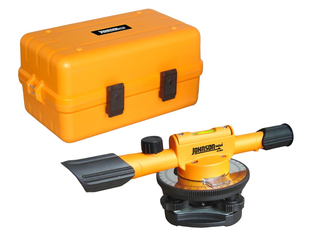
Builder's Level:
A builder's level is a telescope set up on a rotating platform and tripod. The platform will have levelling screws to create a perfectly horizontal plane for sighting, and will usually be marked with degree increments around the base for measuring turns or height differences between different locations.
Transit / Theodolite:

The builder's transit, or "theodolite" as it is traditional known, is one of the oldest pieces of survey equipment that we still use today. The transit will be set up similar to the builder's level on a tripod, adjusted with levelling screws and sighted through an eyepiece.
A transit is different from a builder's level in that it is more accurate for measuring degree turns and can also measure vertical angles of rise. The set up of the transit can include hanging a plumb bob from the bottom of the tool to delineate a corner location on a property or starting point for a building.
Laser Transit:

With the addition of modern technology like GPS and laser light projectors, builder's levels and traditional transits have been mostly replaced with modern laser transits. These units are set up the same as their manual version cousins, but may incorporate self-levelling and rotating laser lights and sensors that can read distance and height from reflective surveyor poles, as shown in the photo here.
Total Station:

The most sophisticated surveying and site projection tool is called a 'total station', which combines builder's levels and laser transits with GPS and even augmented reality headsets. The total station unit may have onboard computing power and memory storage for large jobs, and may also have the capability of interfacing with heavy machinery GPS to maintain level across an entire construction site.
This kind of high-end tool would mainly be used in large developments, commercial construction or civil engineering and infrastructure.